
You are here

Belmont, N.C.
Walk the land to see your future home.
or scroll the land
Welcome to
Canady Preserve.
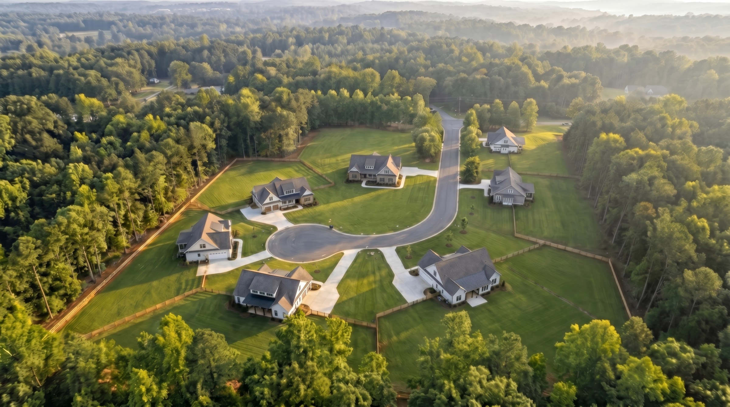
Seven homes, one piece of land — never on the market
THE LAND
A peninsula held on three sides by the Catawba — old textile country.
THE BUILDER
A story teller and dreamer who builds homes, not houses.
THE PRESERVE
Held quiet on purpose — the woods kept around the homes, not cleared for them.
THE HOMES
Six footprints, drawn around the way you actually live.
The Homes
Five homes available.
Seven lots on one piece of land. Five hold a home you can still claim, one is being matched to its plan, and one is already lived in.
Tap a home to open its homesite
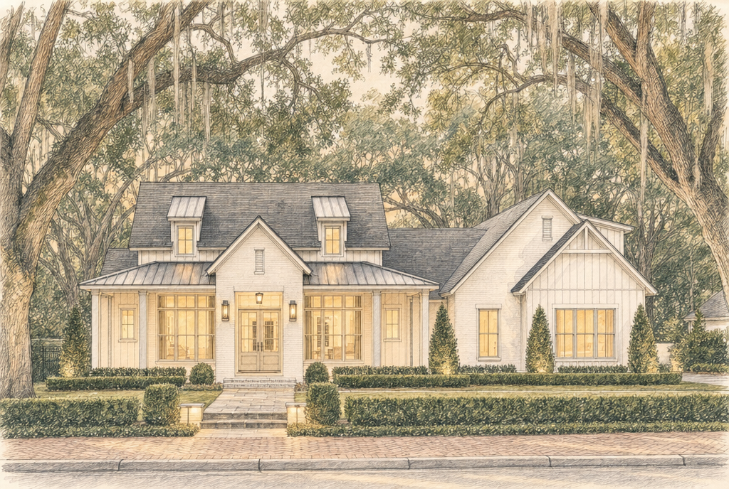
Evie
DraftLot 1 · 0.79 AC
2,657 SF · 3 BD · 3½ BA · 2-car
View homesite →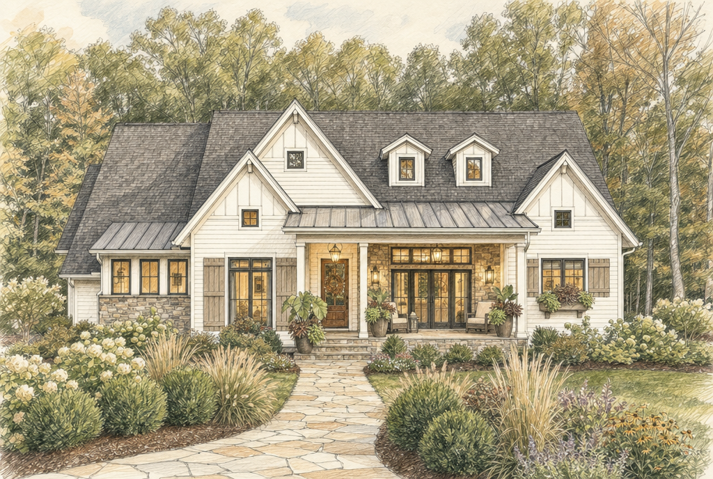
Alvin
DraftLot 2 · 0.79 AC
2,822 SF · 3 BD · 2½ BA · 2-car
View homesite →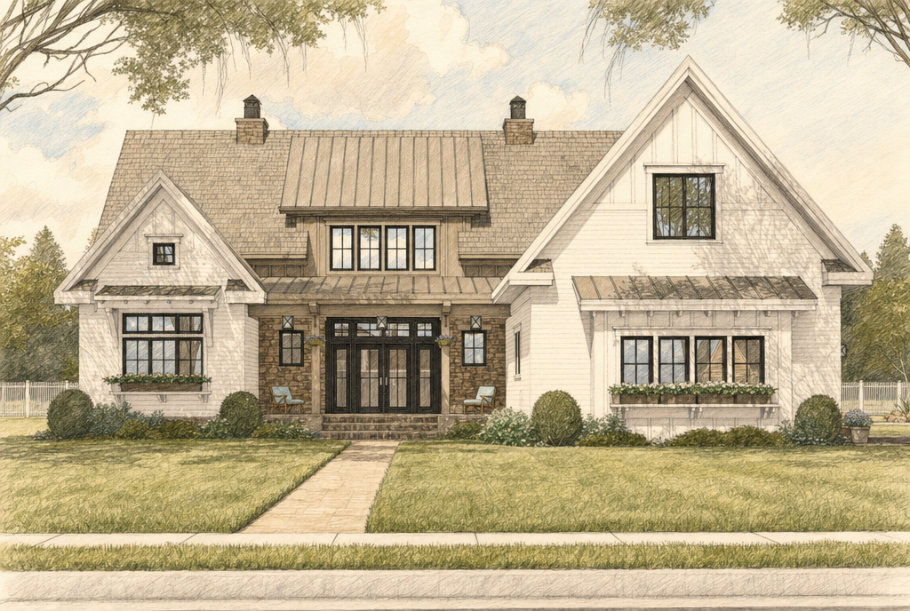
Roland
DraftLot 3 · 1.36 AC
3,672 SF · 4 BD · 4 BA · 2-car
View homesite →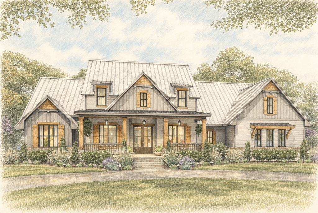
Barney
DraftLot 6 · 1.14 AC
3,050 SF · 3 BD · 2½ BA · 2-car
View homesite →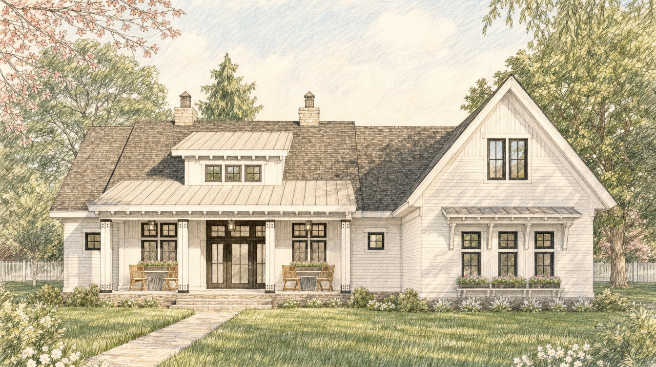
Gertrude
DraftLot 7 · 0.96 AC
2,665 SF · 3 BD · 2½ BA · 2-car
View homesite →The Land Around It
Canady, in facts.
Sourced figures for Canady Preserve on Neumann Run — schools, what's nearby, and how the plat sits.
Schools
New Hope Elementary School
K–5 · ~3.3 mi
~520 students. Assigned public elementary for Neumann Run.
Source: New Hope Elementary School →Cramerton Middle School
6–8 · ~4.1 mi
601 Cramer Mountain Road, Cramerton · ~909 students.
Source: Cramerton Middle School →South Point High School
9–12 · ~3.6 mi
906 South Point Road · ~955 students.
Source: South Point High School →From Neumann Run
Drift on Lake Wylie
2.4 mi · 4 min
315 M Lanyard Lane — lakefront chophouse with weekend brunch. Fastest route via NC-279 W (Google Maps, June 2026).
Source: Google Maps — Neumann Run →Daniel Stowe Conservancy — Trailhead Store
2.0 mi · 6 min
6500 South New Hope Road — gateway to eight miles of free trails (Pond Loop, Persimmon, Worrell's Walk, Stowe Connector). Via NC-279 W.
Source: Google Maps — Neumann Run →Historic downtown Belmont
5.9 mi · 11 min
100 North Main Street — Main Street shops, Stowe Park, and Belmont Abbey College. Via Armstrong Ford Road and NC-279 E / South New Hope Road.
Source: Google Maps — Neumann Run →Harris Teeter — South Point Town Center
6.0 mi · 12 min
905 South Point Road — grocery and errands. Via Armstrong Ford Road and NC-279 E / South New Hope Road.
Source: Google Maps — Neumann Run →CaroMont Regional Medical Center — Belmont
8.5 mi · 16 min
1000 CaroMont Parkway — full-service hospital with emergency department. Via NC-273 S, Armstrong Ford Road, and NC-279 E / South New Hope Road.
Source: Google Maps — Neumann Run →Charlotte Douglas International (CLT)
13.0 mi · 23 min
Via Wilkinson Boulevard — usual traffic (Google Maps, June 2026).
Source: Google Maps — Neumann Run →Uptown Charlotte
20.3 mi · 29 min
Via I-85 S — usual traffic (Google Maps, June 2026).
Source: Google Maps — Neumann Run →The preserve
Neumann Run
The road
Seven homesites on a private cul-de-sac at the end of Neumann Run, branching south from Dixon Road on Belmont's South Point peninsula.
Source: Canady Preserve preliminary plat (Cloninger Bell, 2026-03-19) →South Point peninsula
The setting
Between Lake Wylie and the Catawba River — four minutes to Drift, six to the Trailhead Store at Stowe, twelve to Harris Teeter on South Point Road.
Source: Google Maps drive times — Neumann Run →Community well and septic
Water & septic
Shared community systems serve the plat — not municipal water or sewer.
Source: Canady Preserve — Preston build standards →